|
Maps |
1854 Treaty Area
| 1854map.pdf |
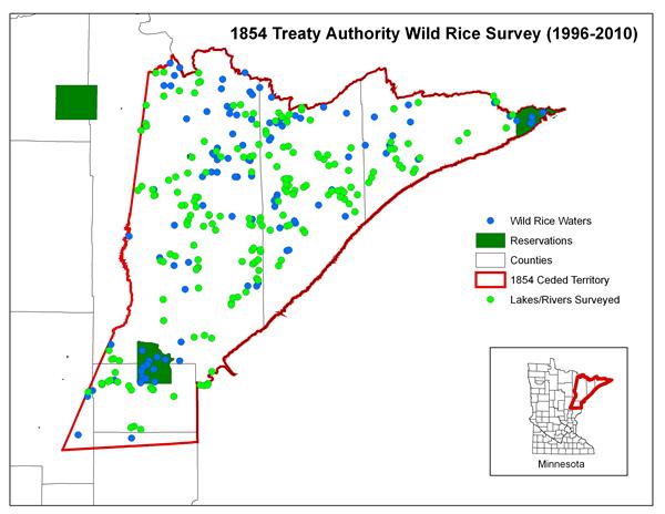
1854 Treaty Authority Wild Rice Survey Map
/uploads/7/1/3/4/7134305/surv10.jpg
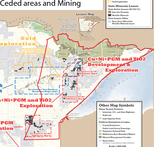
1854 Ceded Areas and Mining
/uploads/7/1/3/4/7134305/1854_ceded_and_mining_areas.jpg
Tribal Land Cessions in Minnesota
/uploads/7/1/3/4/7134305/land_cessions_in_mn_map.docx
Metallic Mineral Leases and Exploration Boreholes in the Ceded Territory
| mining_map.jpg |
General Distribution Map of Wild Rice by DNR (from 2008 study)
| wild_rice_map_with_sulfade_boundaries.pdf |
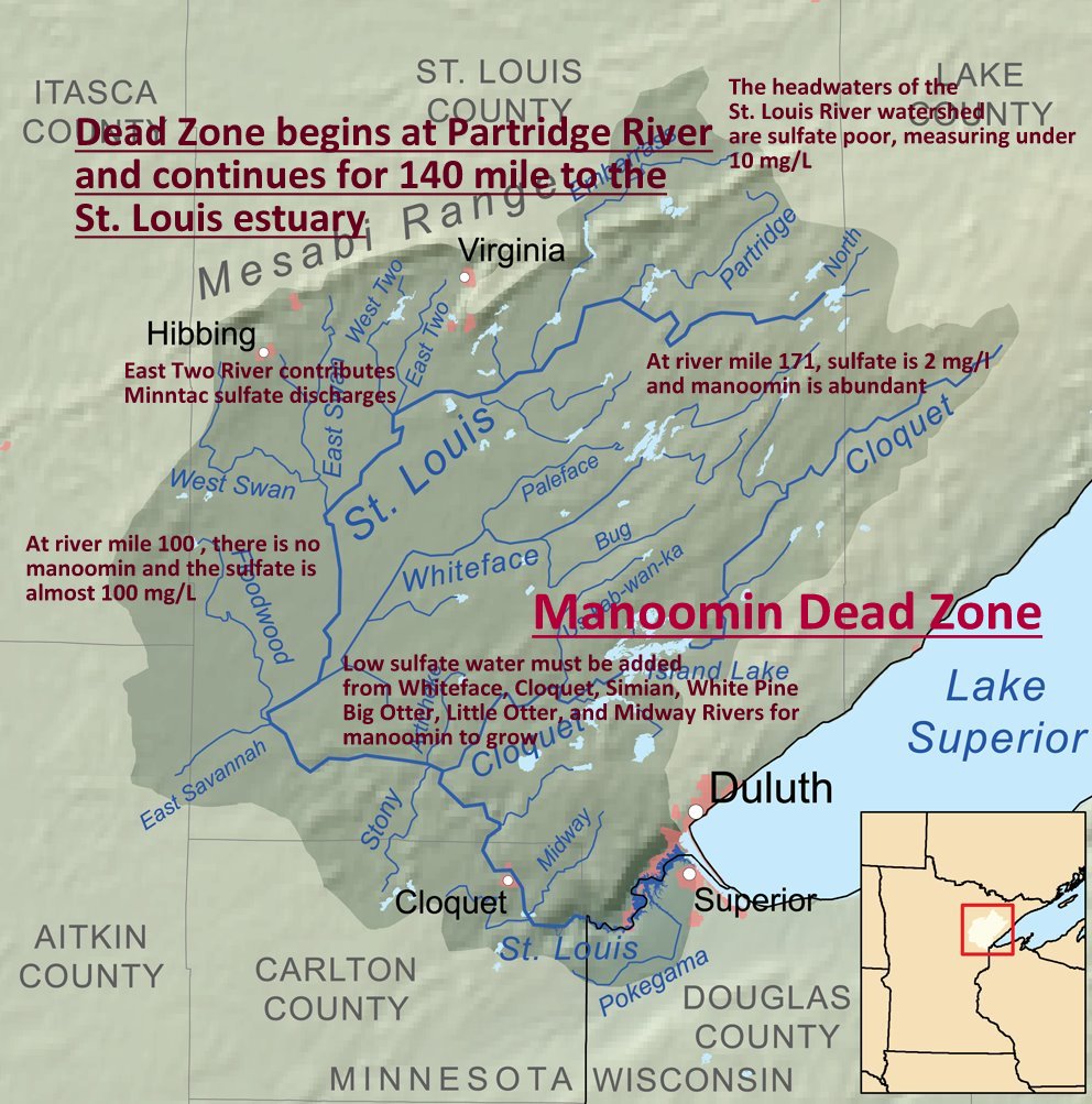
Wild Rice Dead Zone / St. Louis River
| wild_rice_dead_zone.jpg |
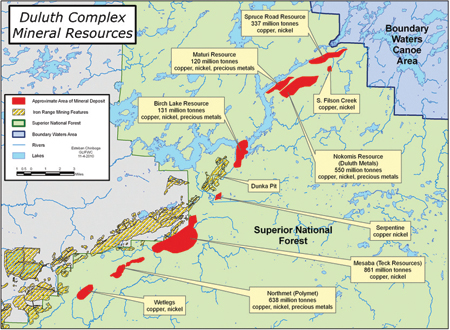
Duluth Complex Mineral Resources
| duluth_complex.jpg |
Areas of Wild Rice Production within PolyMet Project and Tailings Area
Embarrass River
| plmwildrice_map_embarrassr.pdf |
Partridge River
| plmwildrice_map_partridger.pdf |
Indian Lands in EPA Region 5
/uploads/7/1/3/4/7134305/map.pdf
Potential & Proposed Mining Map
| map_of_mining_in_great_lakes_basin.pdf |
Sulfide Mining Activity in Northern Minnesota
| send-polymet-to-summer-school-map-and-fact-sheet1.pdf |
Northeastern Minnesota: Public Lands & Past/Present Mineral Exploration, Preference Rights and Lease Sale Areas
| mcea_mining_footprint_march2009.pdf |
Minnesota Cu+Ni+PGM. TiO2 Deposits, and
Active State Metallic Minerals Leases
| pdac2011_panels_coppernickelpgm_email.pdf |
Active Gold Exploration in Minnesota's Greenstone Belts
| pdac2011_panels_gold_email.pdf |
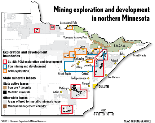
Index Map to Exploration and Development in Northern Minnesota
| pdac2011_panels_indexmap_email.pdf |
Active and Terminated Minerals Leases, and
Areas Ever Offered for MN Lease
| lease_map_010111.pdf |
Mines, Mineral Exploration and Mineral Leasing in the
Lake Superior Watershed
| mining-activity-lake-superior-2011_1.pdf |
Mineral Exploration and Development in Northern Minnesota
/uploads/7/1/3/4/7134305/minerals1006.png
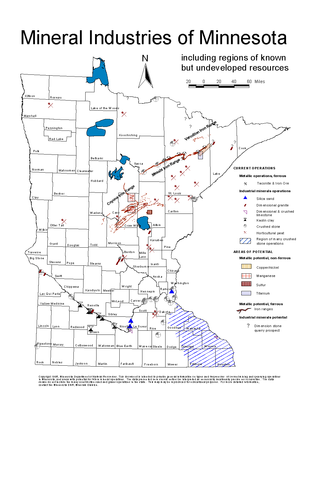
Mineral Industries of Minnesota -
Note Location of Kennecott/Rio Tinto in Cuyuna Iron Range (North of
Lake Mille Lacs)
| minmap.gif |
